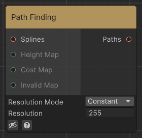
Modifies the Input spline to follow a path provided the different input maps.
- Height Map: If provided, it will try to find a path along the height map keeping the maximum height difference under Max Height Difference
- Cost Map: Extra map with a set Cost Strength for the path to avoid
- Invalid Map: If set, the path will never cross that area.
- Resolution Mode: Choose a fixed sample count or a dynamic sampling step for pathfinding.
- Resolution: Sample count used in Constant resolution mode.
- Steps Per Sample: Sampling step used in Dynamic resolution mode.
- Cost Strength: How strongly the cost map influences the chosen path.
- Height Strength: How strongly height differences influence the chosen path.
- Max Height Difference: Maximum height difference allowed between neighboring path samples when the Height Map is used.
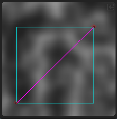
Input
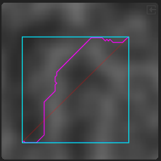
Output